
GEBA Consulting LLC
Data Science & GeoAI Internship

GEBA Internship Program

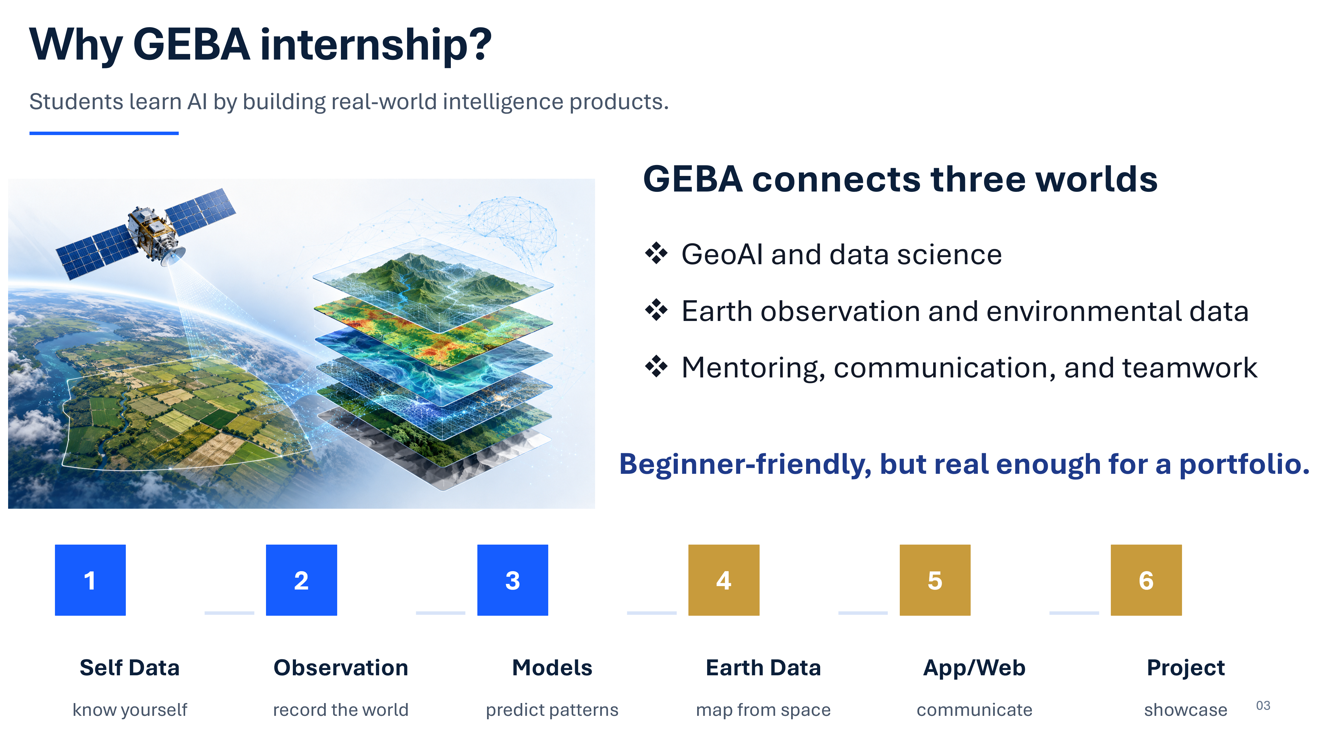
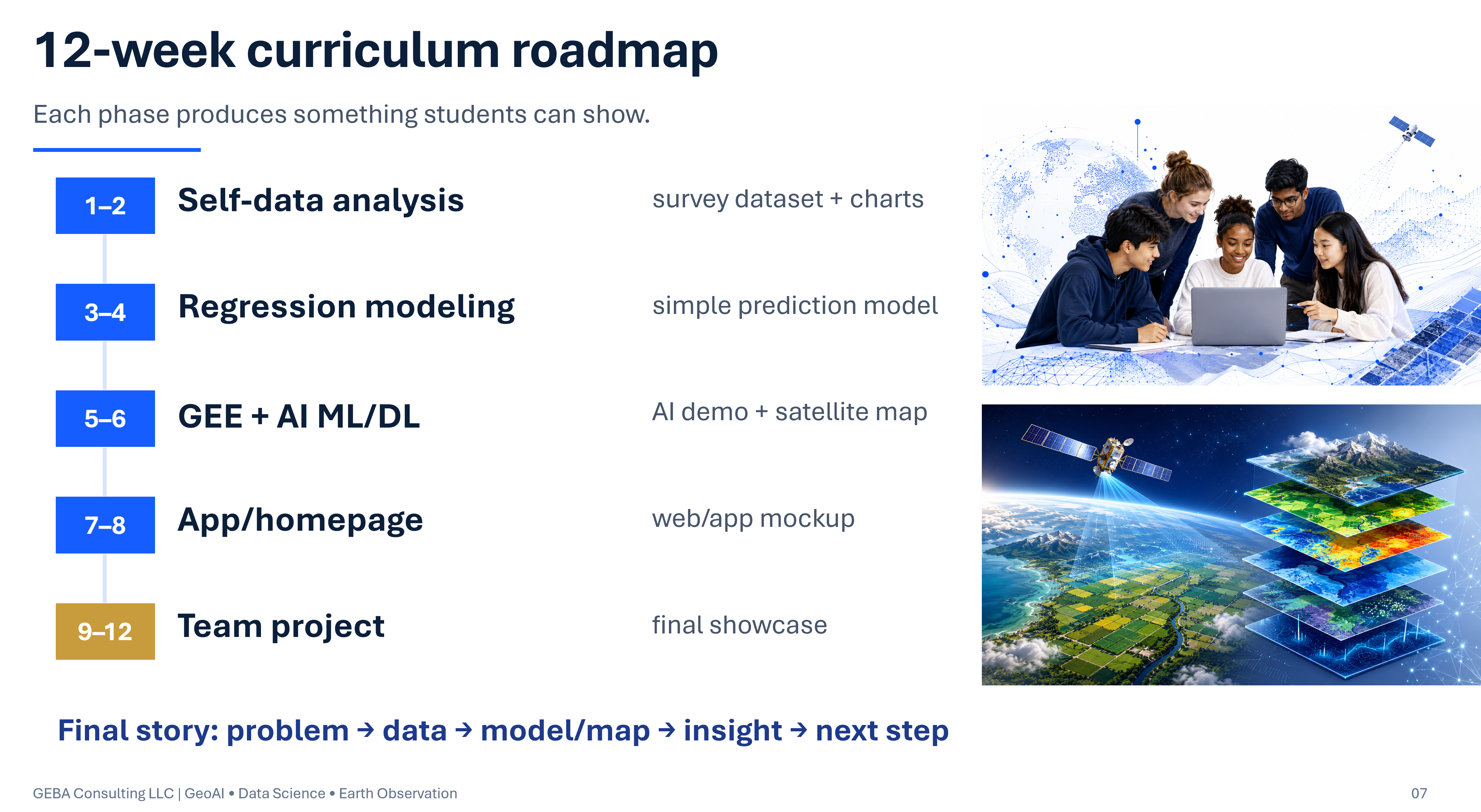
GEBA Internship Program is a practical 8–12 week learning experience offered during the June–September period for high school and university students interested in GeoAI, data science, remote sensing, coding, environmental intelligence, and real-world project development.
GEBA GeoAI and Data Science Internship Program
Internship Program

From curiosity to practical real-world projects

The GEBA internship introduces students to data science, coding, visualization, digital tools, and practical problem solving through hands-on learning and team-based projects. The program is designed to make technology and data more approachable by connecting everyday questions and real-world challenges with practical exercises and project development.

GEBA 12-week internship schedule
Internship History (June–Sep., 2026)

Activities, learning moments, project progress

Internship journey with weekly photos, short descriptions, student learning activities, and project milestones.

Week 1 virtual internship orientation

Week 1 · Virtual Orientation

The internship began with a virtual orientation introducing the program structure, learning goals, and 8–12 week roadmap. Students were introduced to data science, GeoAI, Earth observation, and the team project they will develop throughout the program.

Week 2 · Data Science

Students learned the fundamentals of data science and how raw data can be organized, explored, and interpreted to answer real-world questions. Hands-on activities introduced basic data analysis workflows and encouraged students to identify patterns, variables, and relationships in data.

Week 3 data visualization practice

Week 3 & 4 · Visualization & Analysis

Students practiced transforming data into visual information using charts and graphical displays. The activities focused on understanding how visualization can reveal trends, comparisons, and patterns that may be difficult to recognize from raw numbers alone.

Week 4 prediction modeling

Week 3 & 4 · Prediction Modeling

Students were introduced to predictive modeling and how data can be used to estimate unknown or future outcomes. They practiced connecting input variables with model results while learning the importance of interpretation, accuracy, and model evaluation.

Week 5 Earth observation

Week 5 & 6 · Earth Observation

Students explored Earth observation and learned how satellites and remote sensing provide information about the Earth's surface and environment. They examined spatial imagery and discussed how environmental conditions can be observed and analyzed from space.

Week 6 Google Earth Engine practice

Week 5 & 6 · Google Earth Engine

Students gained hands-on experience with Google Earth Engine for exploring satellite imagery and geospatial data. They practiced navigating locations, examining Earth observation datasets, and connecting cloud-based mapping tools with GeoAI and environmental applications.

Week 7 & 8 · Webpage and App Development

Coming soon

Week 9 & 10 · Field Survey

Coming soon

Week 11 & 12 · Lyme-AIert App Development

Coming soon

Student Project Apps

Student-developed apps and project links

As students build team projects, this section will link to simple web apps, maps, notebooks, dashboards, or GeoAI demonstrations developed during the internship.

Student Projects

2026 Collaborative Project

GeoAI Lyme Alert — A team project using geospatial data, Earth observation, and AI to develop an interactive Lyme disease risk and alert application.

Contact

Internship inquiries

For internship questions, collaboration, or student participation inquiries, contact GEBA Consulting LLC.

Email: info@gebaconsulting.com

Website: gebaconsulting.com

Location: Vienna, Virginia, USA